
Trace a Los Gatos Street by Address
A Los Gatos street directory search should begin by normalizing the address. Keep the direction, street type, unit, and any older spelling. USPS can confirm the delivery form, but the county Assessor and GIS layers decide how the parcel is identified. The public property result may hold more than one situs address, so a single street line is not always a single tax parcel.
Use the address to find an APN, then let that APN link the current parcel to a transfer reference, GIS polygon, permit record, and older deed. A voter lookup cannot be browsed across a street, so it is not a substitute for the address chain. Historic reverse directories and census schedules can add household names, but they are snapshots with gaps.
- Normalize the address and retain every direction, suffix, unit, and alternate form.
- Run the situs address or APN through the Santa Clara County Assessor.
- Open the County or Town GIS view and compare the parcel with its frontage.
- Carry the latest transfer document number to the Clerk-Recorder and read the legal description.
- Search permits, then use reverse directories and census years for earlier households.
Note: A street-by-street record trail is strongest when the same APN or legal description survives each handoff.
Search Los Gatos Parcels Three Ways
The Santa Clara County Assessor Real Property Search offers Simple Address, Advanced Address, and Search by APN. The public tool has no general owner-name input. For Los Gatos by-address research, that limitation changes the order of work: begin with the situs address, then preserve the APN and latest transfer reference before looking for people or older instruments.
| Property address | Simple mode accepts a situs address and may offer partial suggestions. |
|---|---|
| Street number | Advanced mode uses the numeric house number. |
| Street name and type | Enter the name without the suffix, then select a street type when available. |
| Direction | Use the dropdown for a directional prefix where the address has one. |
| Unit | Keep a suite or unit separate when a parcel carries several situs addresses. |
| City | Select Los Gatos in Advanced mode for the situs record. |
| APN number | Enter eight digits, with or without the displayed dashes. |
| Terms acceptance | The terms checkbox is required before the search runs. |
The result can show APN, situs address, mailing address, current transfer document number and date, values, exemptions, tax-rate area, and taxing districts. The inspected Villa Avenue sample result shows why multiple situs addresses and a San Jose mailing address must be kept separate. Owner name is not displayed in the public result. A homeowners’ exemption is a clue consistent with owner occupancy, not proof of every person at the address.
The assessor search screen makes the address-first design visible before a researcher spends time on a name search.
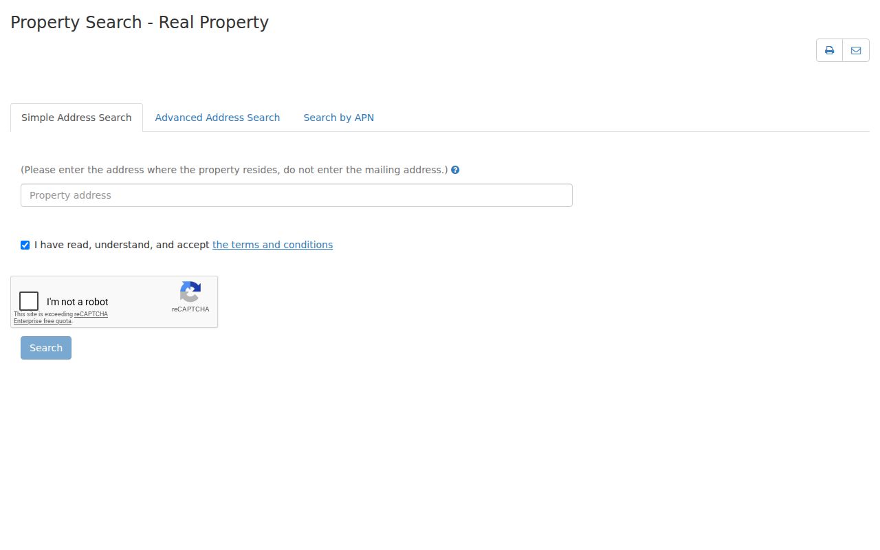
That portal is the first key in the address chain because it turns a street line into an APN and a document lead.
Walk Adjacent Los Gatos Parcels in GIS
The map step belongs after the assessor step. Use the APN in the Town of Los Gatos interactive GIS instructions or the County GIS application. Select the target parcel, note the polygon and frontage, zoom until adjoining parcel lines are clear, and click each parcel that touches or faces the target. A nearby marker is not enough to establish that two sites share a block.
For each selected parcel, record the APN and situs separately. Run each one through the Assessor because the map does not create a household roster. County and Town layers can also clarify tax districts, roads, and municipal boundaries. In mountain areas, a Los Gatos mailing city may cover a parcel outside the incorporated Town, so the GIS jurisdiction layer is a better guide than the postal label.
Note: If a live map offers no buffer tool, click the actual adjacent polygons one at a time and keep the selection method in your notes.
The County GIS landing screen shows the map applications that support this parcel-first approach.
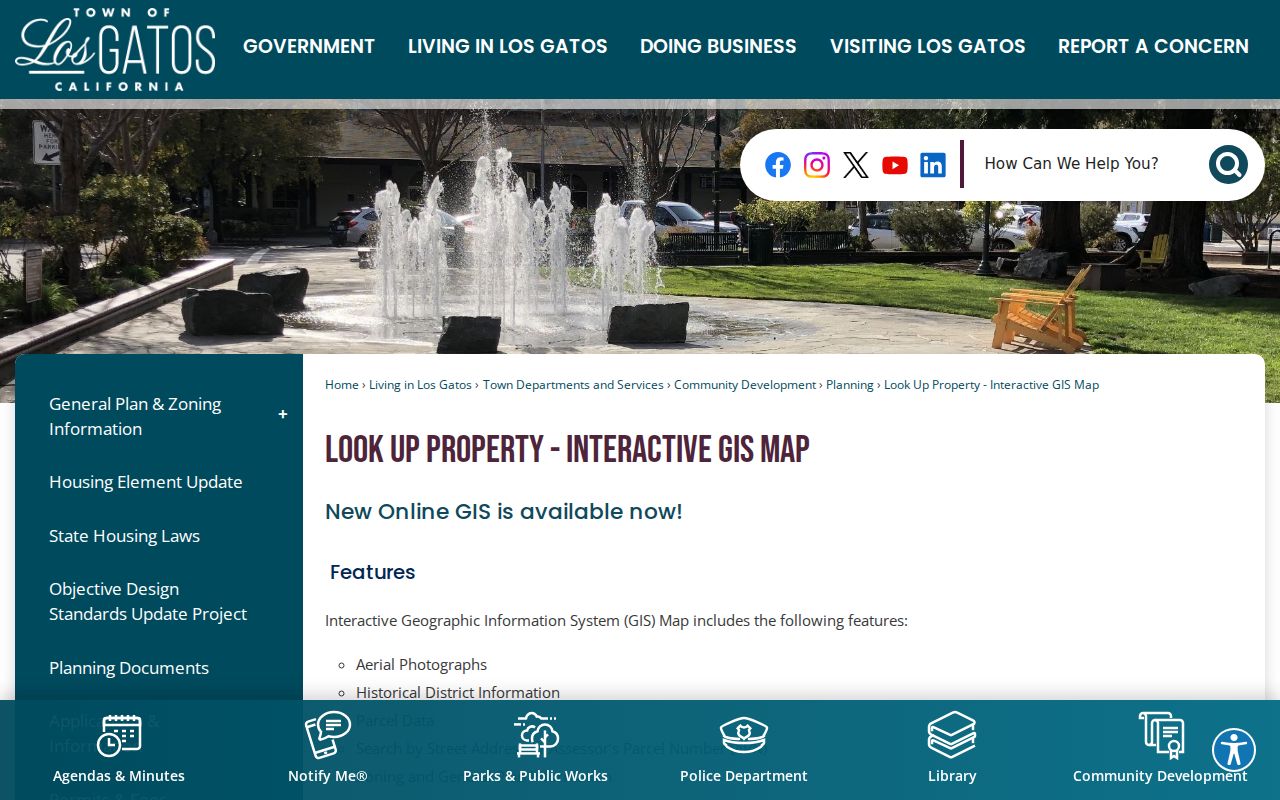
Map geometry can establish which lots sit beside a Los Gatos address, but only a custodian’s record can establish the meaning of a name or contact.
Los Gatos Address Records in One Chain
Every address-keyed source in the Los Gatos record chain answers a narrow question. The table below keeps the source role visible. Ownership, assessment mail, permit contact, voter registration, and historical occupancy should not be folded into one claim simply because they share a street address.
| Record set | Keeper | Street evidence | Blind spot |
|---|---|---|---|
| Assessor result | Santa Clara Assessor | Situs, mail, values, exemption, transfer reference | No household roll or owner-name input |
| GIS parcel map | County or Town GIS | Parcel geometry, frontage, districts, adjacent lots | Map selection is not occupancy evidence |
| Recorded deed | Clerk-Recorder | Named parties, transaction, legal parcel | A recorded interest may not equal presence |
| Town permit | Community Development | Project, date, applicant, contractor, site | Contact role is not resident status |
| Voter record | Registrar of Voters | Approved registration information | No open street browsing |
| Reverse directory | Libraries and regional archives | Historic subscriber or household by address | Missing years and unlisted names |
Use the APN to tie the property result to a deed or permit. Use the street and house number to find a reverse entry. Use dates to decide whether two records overlap. This is the difference between a reproducible address index and a loose collection of similar addresses.
Los Gatos Permits by Site and Date
The Town permit system adds a dated project trail. Public pending and issued building permits reach back to 1994, while older history is held in Laserfiche or microfiche at the Building counter. A permit application may identify project address, APN, property owner contact, applicant, contractor, work description, valuation, inspection status, and historic or fire-related flags. The roles need to stay labeled. An applicant, architect, contractor, or business contact is not automatically the owner or a household member.
Use a permit to explain a changed unit count, addition, demolition, solar work, reroof, or historic alteration. Compare the date with the deed and assessor transfer reference. A no-result before the online range is a prompt to ask the counter, not evidence that the property had no permit history. Building is at 110 E. Main Street, with Building at 408-354-6876 and Planning at 408-354-6874. Public Works and Engineering is at 41 Miles Avenue at 408-399-5771.
Start with the Los Gatos building-permit search when the question is about a dated site change. The Town Permit Center explains the broader planning and building route.
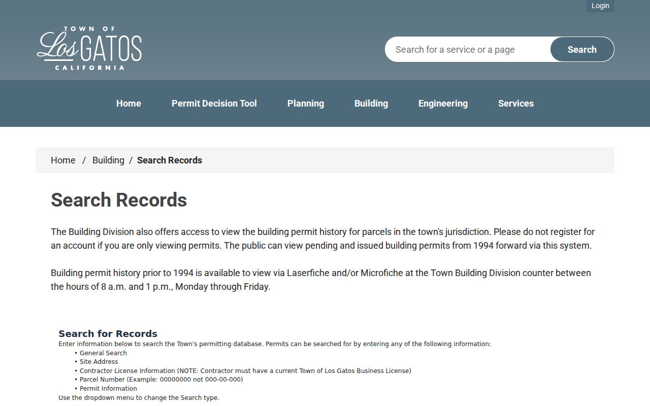
A permit result can add context to a street address, but it should never be rewritten as proof of who lived there.
Carry a Los Gatos Transfer Number to the Recorder
The Clerk-Recorder’s official-records web index has been offline since November 5, 2018. Current public research therefore runs through the office. Records from 1981 forward can be searched on public workstations. The 1850-1980 range uses Digital Reel. The office does not perform the full title search, and busy terminals may be limited to one hour. Bring the latest document number from the Assessor, a name, or a book-and-page reference, especially for an older instrument.
Read the recorded instrument for grantor and grantee, record date, document type, legal description, and any map or parcel clue. For a backward chain, search the current grantor as an earlier grantee, then confirm the same legal description or APN. Trust, corporate, married-name, and spelling variants may require more than one pass. Keep execution date, recording date, and assessment transfer date in separate columns.
Note: The latest transfer number is the practical bridge from a free Los Gatos property result to an office-only recorded-document search.
Los Gatos Criss-Cross Volumes
Older Los Gatos street directory work depends on the reverse side of a volume. The library’s R.L. Polk and telephone holdings include Los Gatos sections from 1930 through 1974, with gaps. Many volumes place a telephone-style portion beside a pink section arranged by street, house number, and resident. History San José supplies a regional fallback from 1870 through 1979 and a reverse address index beginning in 1914. The library and regional shelf should be checked for the exact publisher, missing year, and photocopy rule.
Federal census schedules through 1950 offer a dated household check. Compare a directory just before or after a census with the household’s names, ages, relationships, birthplace, occupation, and tenure. Newspapers and the Los Gatos funeral-home index can explain a move or death. The full volume list and entry-reading method are on the Los Gatos city directory collections page.
- Criss-cross directory
- A reverse section arranged by street and number rather than only by surname.
- Address key
- The normalized street, number, unit, and APN used to join records.
- Snapshot
- A source tied to one publication or enumeration date, not a continuous occupancy record.
ZIP Lines and Los Gatos Street History
ZIP geography can mislead a street directory. ZIP 95030 covers the town core, 95032 reaches toward Campbell and San Jose, and 95033 uses Los Gatos as a postal city across mountain and unincorporated communities. ZIP 95031 appears in local postal data as a companion designation that needs exact USPS verification. The postal city does not decide whether a parcel sits inside Town limits.
The Town annexed 24 of 30 county urban islands in 2019, adding 308 residential parcels and about 116 acres. A pre-annexation permit, police record, or road record may therefore have a county custodian even when the present address reads Los Gatos. The supplied research did not verify a universal street-renumbering year. For old addresses, compare APN, subdivision plat, Sanborn sheet, directory spelling, and legal description instead of inventing a conversion date.
Note: Postal city, municipal boundary, school district, service district, and historic social identity can describe different Los Gatos geographies.
Terms That Keep a Los Gatos Street Directory Straight
Address records use short terms that carry different weight. Defining them before a search keeps a street directory from turning a clue into a conclusion.
- APN
- The assessor’s parcel number, used to join a property result to a map or recorded instrument.
- Situs
- The physical site address shown by the assessment record.
- Plat
- A recorded subdivision or survey map that can stabilize lot and street relationships.
- Legal description
- The formal land description in a deed, which may outlast a changed street label.
- Mailing address
- The notice destination, which may be away from the parcel.
In mountain areas, metes-and-bounds descriptions, private roads, wells, septic systems, and county permits may matter more than a clean urban street string. In older downtown areas, a map and a directory may explain a name change that the modern portal cannot.
What the Los Gatos Street Directory Cannot Show
No public street directory shows every household member, delivery record, utility customer, or protected address. The assessor result has no open owner-name input. The voter form is restricted and authenticated. DMV data is shielded by the Driver’s Privacy Protection Act. Police, juvenile, medical, victim, and active-investigation material can be withheld or redacted. A deed may show a legal interest while the person lives elsewhere.
A name that does not appear can reflect a protected record, an unlisted household, a spelling variation, a date gap, or a different jurisdiction. When the goal shifts from a full street chain to one person, use the narrower Los Gatos resident lookup workflow and keep its identity controls intact. Incident questions have a separate Los Gatos-Monte Sereno Police records route with its own exemptions.
Lawful use. Los Gatos address records are for personal, lawful research, family history, and civic understanding. Using them to stalk, harass, intimidate, or harm anyone can violate California law and the limits of the custodians.
Note: The absence of a name from a street search is not proof that the person never lived at that address.